
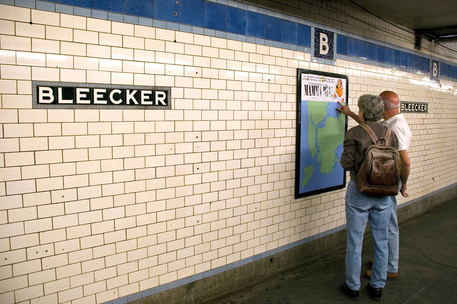
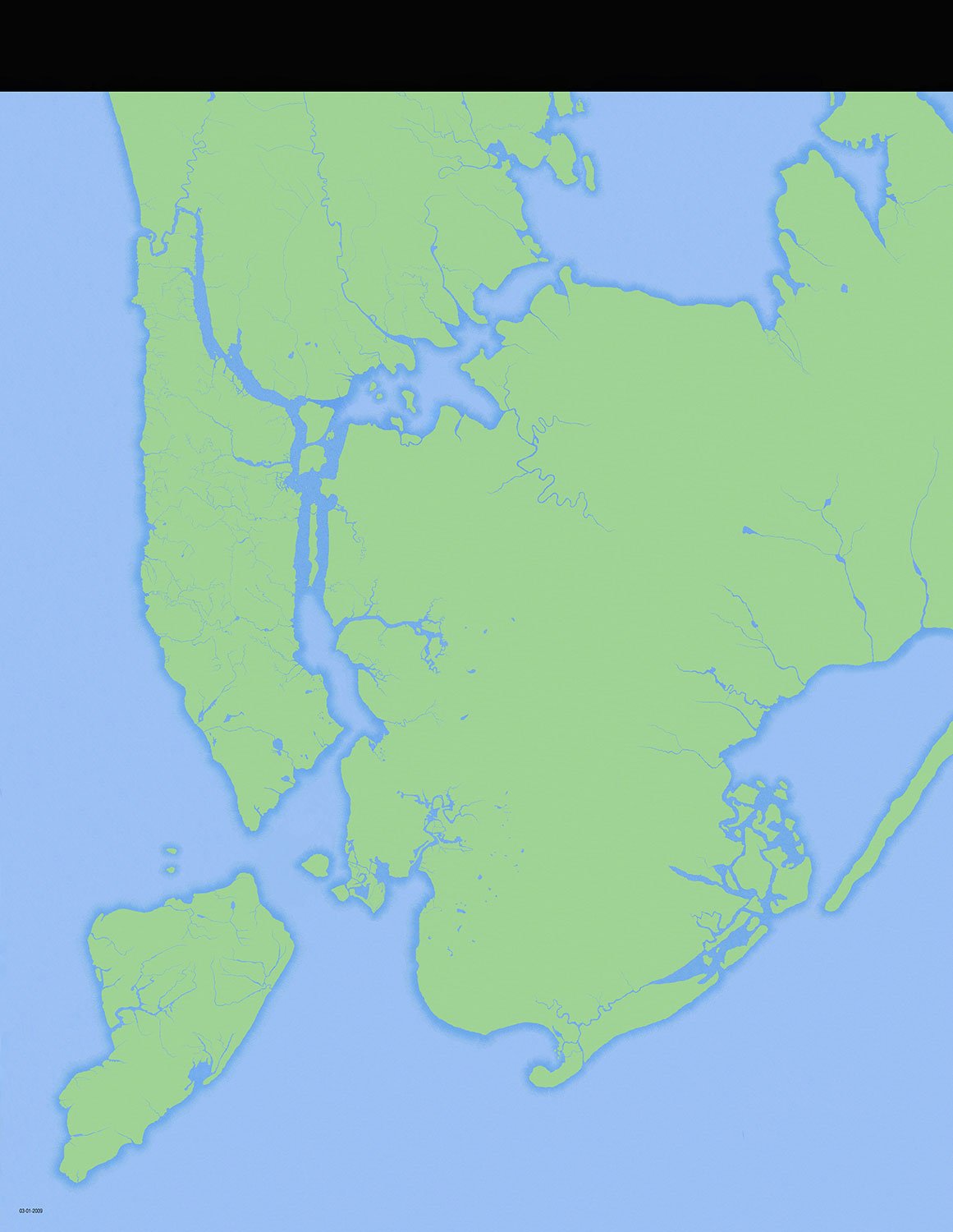
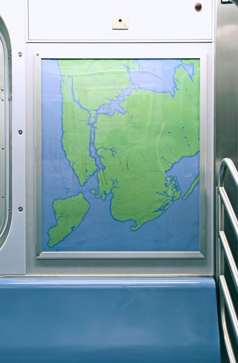
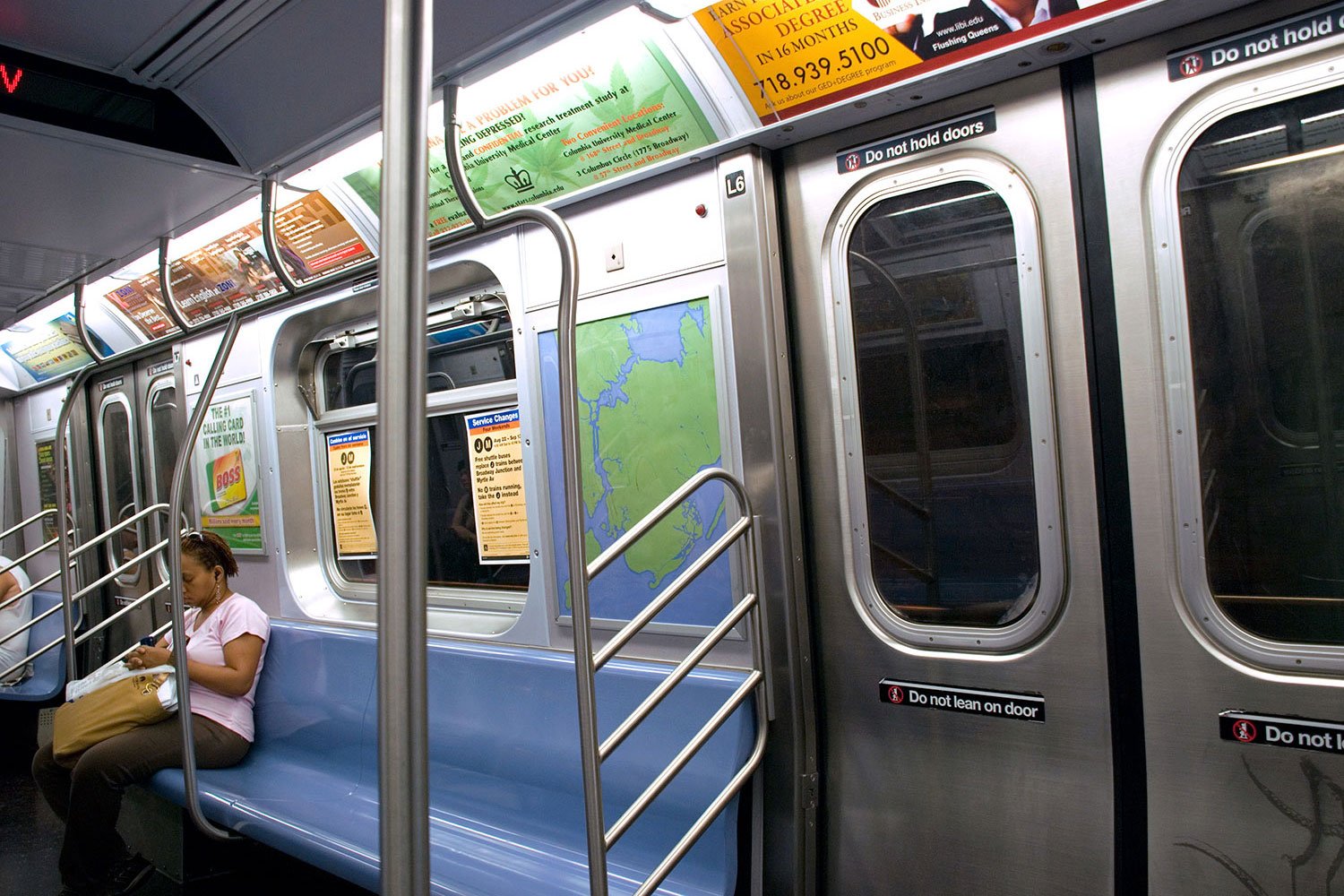
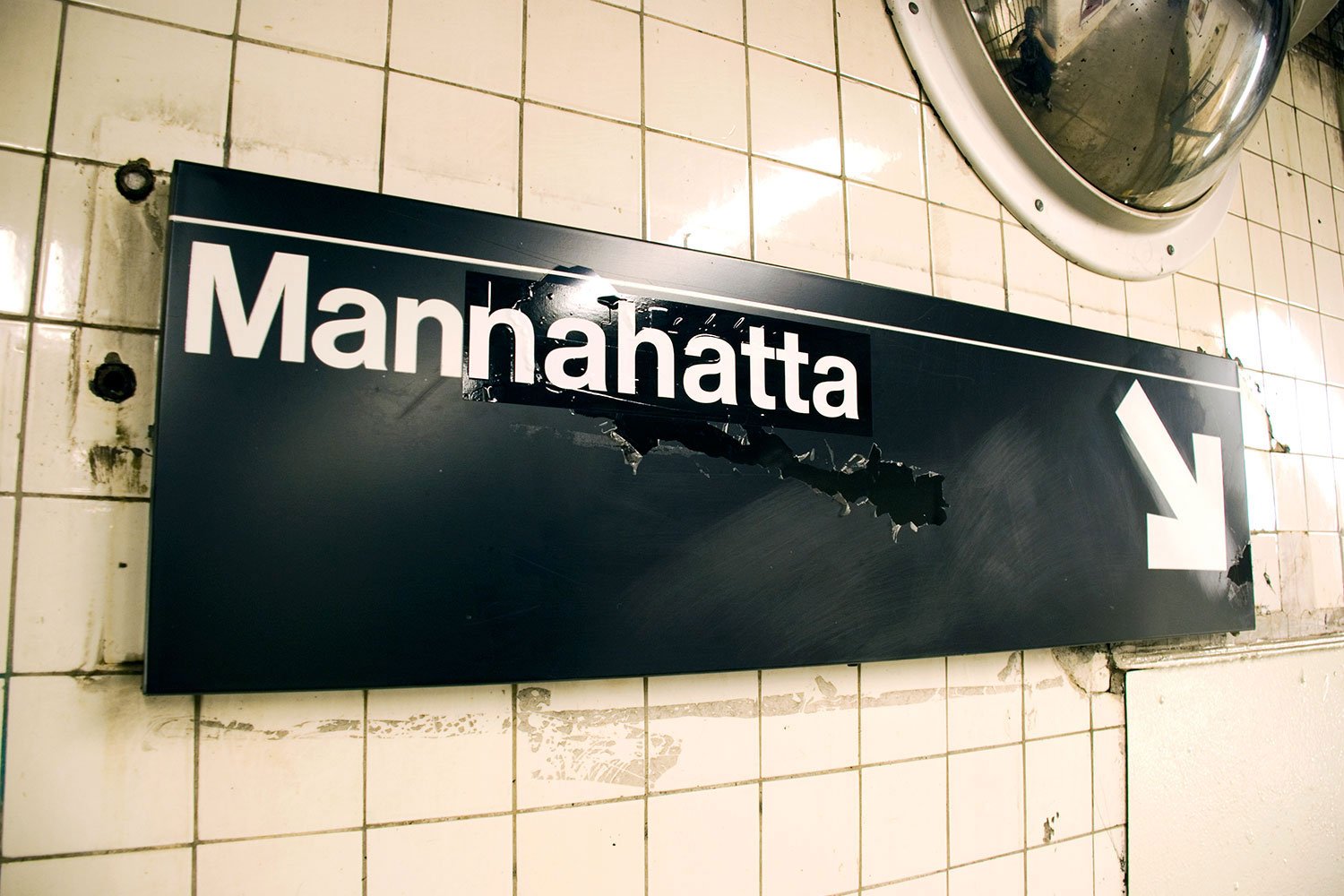
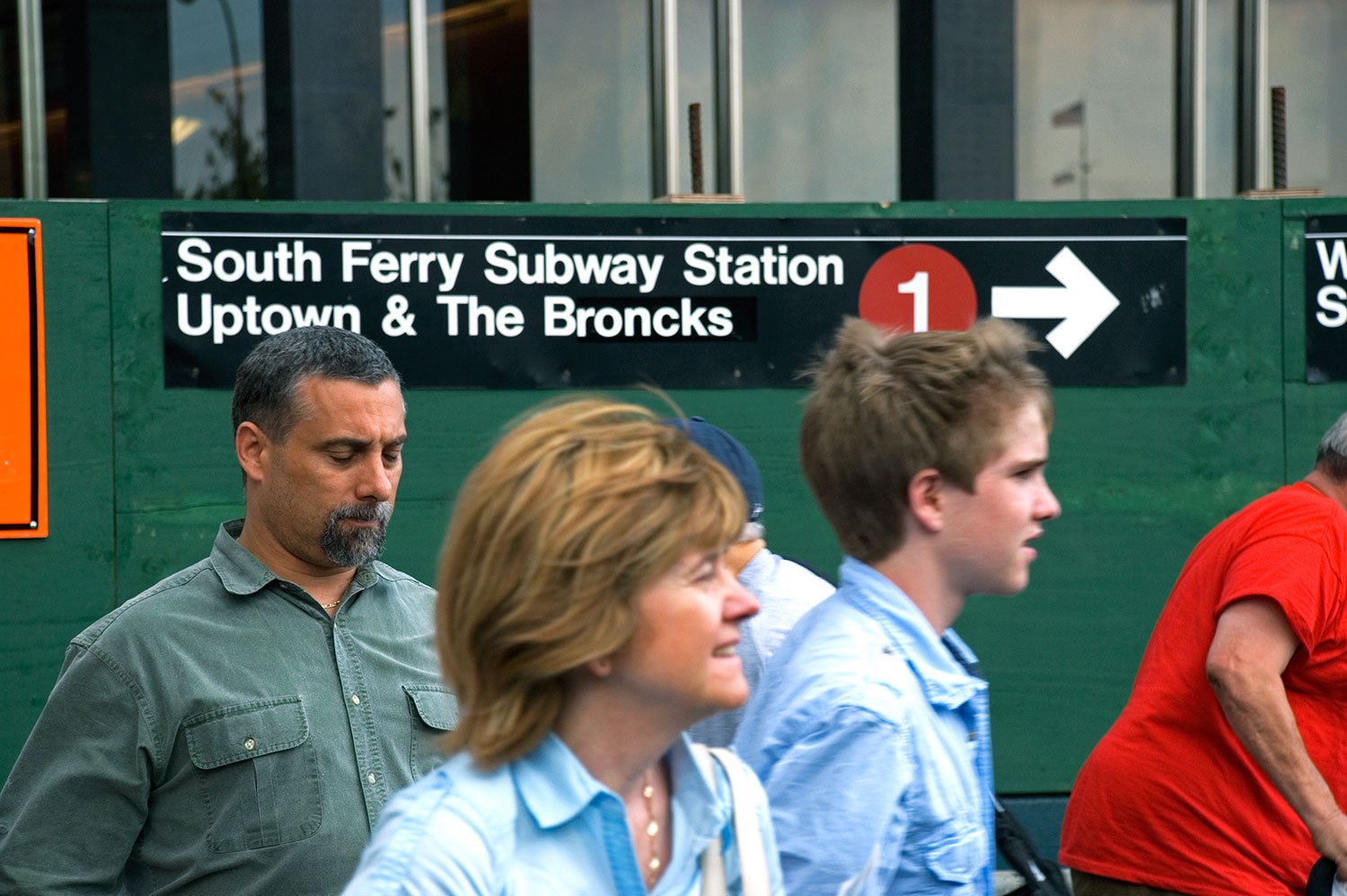
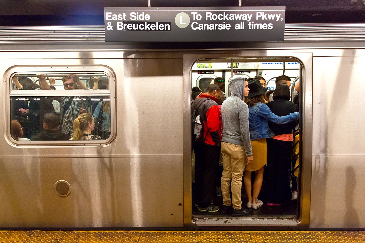
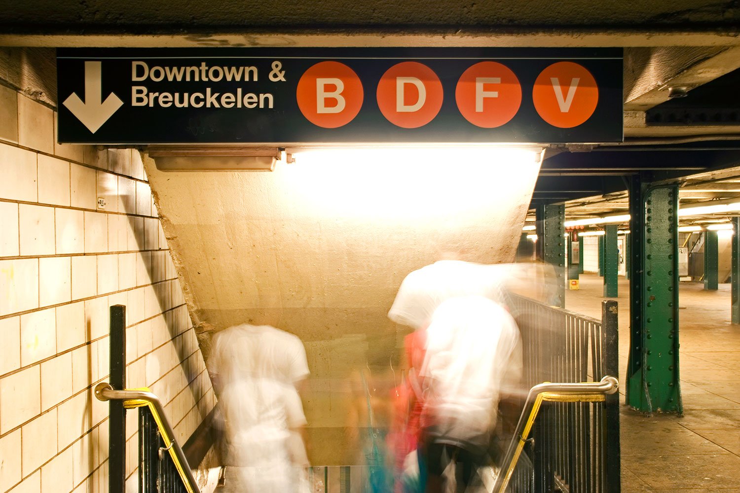
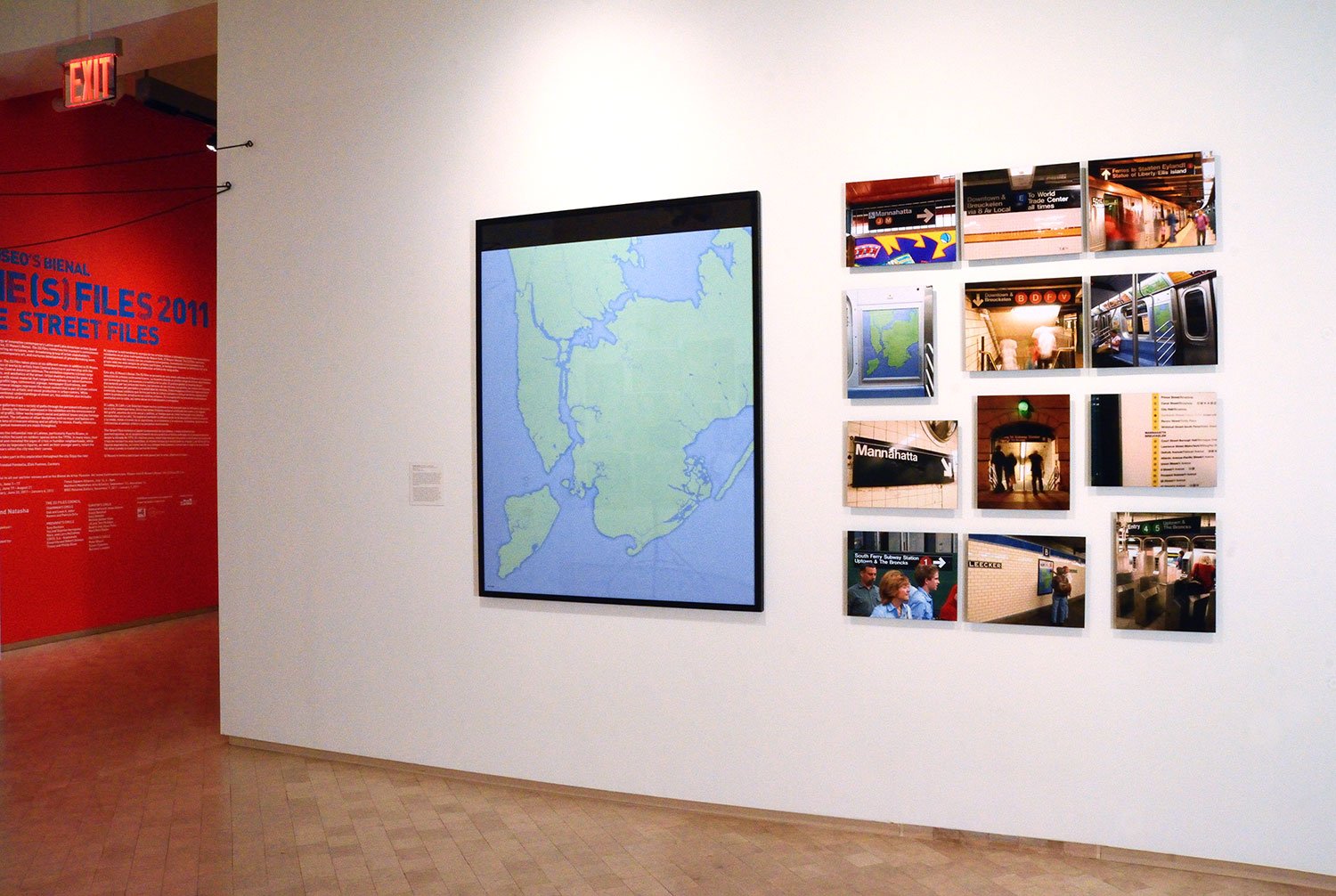
Get Lost! (NYC)
2009-2012
archival pigment print, photographic documentation
The Get Lost! project decolonizes NYC's Metropolitan Transit Authority's subway maps, signs, and place names, to what they may have geographically looked and sounded like prior to colonization in 1609. Documented through photography, these restorations based on 18th-century military cartography and toponymy erase over 400 years of accumulated history.
Place names, neighborhoods, and subway lines are erased, returning New York City to the original green spaces, streams, ponds, and shores the city’s indigenous Lenni Lenape people would have known. Returned and inserted back into the subway system, these site-specific restorations reveal the indigenous, colonial, and military histories of New York City.